Menu
Annapurna Circuit Trek (10 Days) — Ice Lake & Thorong La Pass
Trekking

Annapurna Circuit Trek (10 Days) — Ice Lake & Thorong La Pass

9 Nights 10 Days Nepal

Destination

Nepal

Accommodation

Accommodation Teahouse / Mountain Lodge

Walking Distance

~ 105 km

Duration

9 Nights 10 Days

Max. Elevation

5,416 m (17,769 ft) at Thorong La Pass

Meals Included

Breakfast, Lunch, and Dinner

Best Season

Spring (Mar–May), Autumn (Sep–Nov)

Grade

Strenuous

Overview

The 10-Day Annapurna Circuit Trek with Ice Lake and Thorong La Pass is an extraordinary alpine odyssey through one of the most geographically diverse and culturally rich trekking corridors on Earth. Starting from the subtropical foothills and ascending into the rain-shadow desert of the high Himalayas, this compressed 10-day expedition offers an epic traverse through deep river gorges, alpine forests, and high-altitude trans-Himalayan landscapes.

Beginning with an overland drive to Chamje or Dharapani, the trail follows the roaring Marshyangdi River through ancient Gurung and Manangi settlements. An excursion to the sacred high-altitude Ice Lake (Kicho Tal, 4,600 m) provides vital acclimatization alongside panoramic views of the Annapurna Massif (Annapurna I - 8,091 m, Annapurna II, III, IV), Dhaulagiri (8,167 m), Manaslu (8,163 m), and the striking wall of Gangapurna (7,455 m). The defining achievement of the voyage is crossing Thorong La Pass (5,416 m)—one of the highest navigable trekking passes in the world—before descending to the revered pilgrimage site of Muktinath and returning overland directly to Pokhara.

Best Time to Visit

Timing your journey ensures safe mountain passes, crystal-clear vistas, and favorable trail conditions across diverse climate zones:

·         Autumn Season (September to November): The premier window for high-pass trekking. Post-monsoon atmospheric clarity yields unobstructed peak visibility, dry trails, and stable mountain weather with comfortable daytime walking temperatures.

·         Spring Season (March to May): A vibrant time to trek as lower elevations burst into color with blooming rhododendron, magnolia, and wild orchids. Mild temperatures prevail, and snow lines on Thorong La retreat gradually.

·         Winter Season (December to February): Characterized by crisp blue skies and quiet trails, but extreme cold and heavy snow accumulation can close Thorong La Pass. Requires specialized cold-weather gear and high mountain experience.

·         Monsoon Season (June to August): Heavy rains affect the lower valleys leading to landslides, muddy paths, and leeches. However, the upper Manang and Muktinath valleys lie in the rain-shadow zone and remain dry.

Photos / Videos

No photos available for this package yet.

Trip Highlights

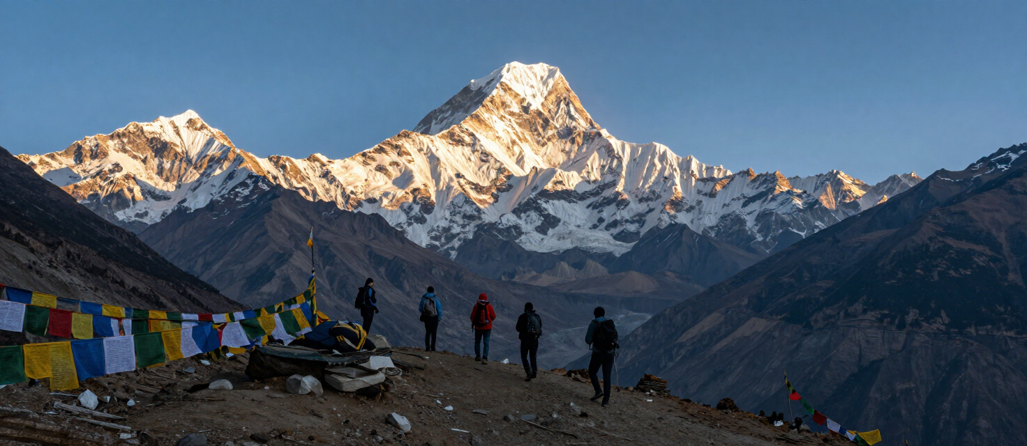
  • • Thorong La Pass Crossing (5,416 m): Conquer one of the highest mountain passes in the world adorned with thousands of fluttering Tibetan prayer flags.
  • • High Altitude Ice Lake (Kicho Tal - 4,600 m): An acclimatization day hike offering reflection views of Annapurna IV, Gangapurna, and Chulu East.
  • • Trilogy of 8,000m Peaks: Unrivaled panoramas of Annapurna I (8,091 m), Dhaulagiri (8,167 m), and Manaslu (8,163 m).
  • • Cultural Shift & Ancient Monasteries: Journey from Hindu Gurung and Magar foothills to Tibetan-Buddhist Manangi villages, visiting century-old gompas in Braga and Jharkot.
  • • Sacred Muktinath Temple: Explore the holy site revered by both Hindus and Buddhists, featuring 108 eternal water spouts and natural gas flame shrines.
  • • Direct Return to Pokhara: Efficient 10th-day overland journey directly from Muktinath/Jomsom through the Kali Gandaki Gorge to Pokhara.

Detailed Itinerary

1 Drive from Pokhara (820 m) to Dharapani (1,860 m)
Trek Distance
~160 km (Drive)
Drive / Flight
~7 to 8 hours
Highest Altitude
1,860 m
Local Teahouse In Dharapani Included meals: Breakfast , Lunch , Dinner

We leave Pokhara early, following the Prithvi Highway before turning onto the rougher mountain road at Besisahar, where the drive shifts into a private or shared 4WD jeep for the climb ahead. The road tracks the Marshyangdi Khola closely from here.

Waterfall-draped canyon walls and small agricultural hamlets like Tal mark the route as the valley steadily narrows and gains height. The change in scenery over just a few hours of driving is one of the more striking parts of the day.

By late afternoon we reach Dharapani, the official entry checkpoint for the Annapurna Circuit. The permit and paperwork stop here signals that the trekking, rather than the driving, begins in earnest tomorrow.


2 Trek from Dharapani (1,860 m) to Chame (2,670 m)
Trek Distance
~15 km
Highest Altitude
2,670
Trek Duration
5 to 6 hours
Local Teahouse in Chame Included meals: Breakfast, Lunch, Dinner Starting Altitude: 1,860 m (Dharapani) Ending Altitude: 2,670 m (Chame)

Dharapani → Bagarchhap → Timang → Chame

The trail climbs steadily through pine, oak and maple forest, tracking the Marshyangdi River as it carves through the valley below. We pass through Bagarchhap and Danaque, small villages still showing strong Tibetan-Buddhist character in their prayer walls and chortens.

A steep stone-step climb brings us up to Timang, and the effort is repaid immediately with a clear view of Manaslu (8,163 m) rising above the opposite ridgeline — one of the better surprise viewpoints on the early stages of the circuit.

We continue through pine-scented forest into Chame, the administrative headquarters of Manang district. Natural thermal hot springs sit just across the river here, a welcome option for anyone whose legs are already feeling the day's climb.


3 Trek from Chame (2,670 m) to Upper Pisang (3,300 m)
Trek Distance
~14 km
Highest Altitude
3,300 m
Trek Duration
5 to 6 hours
Local Teahouse in Upper Pisang Included meals: Breakfast, Lunch, Dinner

Chame → Bhratang → Upper Pisang

Dense pine forest gives way gradually to steep rock walls as we walk toward Bhratang, the trail hugging close to the river for most of the morning. A suspension bridge crossing offers our first proper look at Paungda Danda, a curved rock face rising some 1,500 meters directly above the trail.

Past Bhratang, the alpine terrain begins turning noticeably drier, tree cover thinning with every kilometer of altitude gained. It's a clear signal that we're leaving the wetter, forested lower valley behind for good.

We climb the final stretch into Upper Pisang, rewarded with views of Pisang Peak and the long wall of Annapurna II filling the skyline ahead — a strong preview of the high mountain terrain still to come over the next several days.


4 Trek from Upper Pisang (3,300 m) to Manang (3,540 m)
Trek Distance
~19 km
Highest Altitude
3,540 m
Trek Duration
6 to 7 hours
Mountain Lodge in Manang Included meals: Breakfast, Lunch, Dinner

Upper Pisang → Gyaru → Ngawal → Braga → Manang

We take the scenic high route today rather than the shorter valley trail, climbing toward Gyaru for both the acclimatization value and the views — the ascent opens onto a clear line across the valley floor to Annapurna II and Annapurna IV.

From Gyaru, a high balcony path leads to Ngawal, threading through ancient stone villages that feel distinctly more Tibetan than the lower valley settlements passed earlier in the trip. Mani walls and prayer wheels line much of the trail here.

We descend past the weathered Braga monastery, its prayer walls set dramatically against the surrounding cliffs, before arriving in Manang — a Tibetan-style settlement of stacked stone houses sitting directly beneath the glaciers of the Annapurna range.


5 Acclimatization day hike to Ice Lake (Kicho Tal, 4,600 m)
Trek Distance
~10 km
Highest Altitude
4,600 m
Trek Duration
6 to 7 hours (Round trip)
Mountain Lodge in Manang Included meals: Breakfast, Lunch, Dinner

Manang → Braga → Ice Lake → Manang

Rather than resting completely, we spend today's acclimatization climbing — starting from Braga and following a steep, zigzagging trail north toward the glacial Ice Lake. The gain in altitude is significant, but the pace stays deliberately slow.

As the trail rises through open alpine meadow, the views expand steadily: the full Annapurna Massif, the Gangapurna Glacier, and Tilicho Peak all become visible in turn, each appearing a little closer than the last viewpoint offered.

Reaching Ice Lake itself, a still, ice-fringed pool set against bare rock and glacier, provides exactly the kind of physiological adaptation this high on the circuit calls for. We return to Manang by mid-afternoon, legs tired but properly acclimatized for the days ahead.


6 Trek from Manang (3,540 m) to Ledar (4,200 m)
Trek Distance
~10 km
Highest Altitude
4,200 m
Trek Duration
4 to 5 hours
Local Teahouse in Ledar Included meals: Breakfast, Lunch, Dinner

Manang → Ghunsang → Ledar

Leaving the main Manang valley behind, we climb through alpine scrub and scattered juniper alongside the Jar Sang Khola, the terrain growing steadily more exposed with every passing hour. The pace stays measured, matching the thinning air.

We pass Ghunsang, little more than a scattering of stone buildings where yak herds graze freely on the dry mountain slopes surrounding the settlement. It's one of the quieter, more remote-feeling stretches of the entire circuit.

A wooden bridge crossing brings us onto the final gentle rise toward Ledar, our stop for the night. With Thorong La now only two trekking days away, the mood among the group shifts slightly — more focused, less chatty, as the altitude asserts itself.


7 Trek from Ledar (4,200 m) to Thorong High Camp (4,880 m)
Trek Distance
~7 km
Highest Altitude
4,880 m
Trek Duration
4 to 5 hours
Mountain Lodge in Thorong High Camp Included meals: Breakfast, Lunch, Dinner

Ledar → Thorong Phedi → Thorong High Camp

Today's walk stays short in distance but demanding in altitude gain. We traverse high, open terrain above the riverbank, keeping half an eye out for blue sheep (bharal) and the occasional Himalayan lammergeier riding the thermals overhead.

A suspension bridge crossing brings us to Thorong Phedi, where most trekking parties pause for tea before tackling the steepest section of the day — a roughly one-hour climb up a loose scree slope.

We reach Thorong High Camp by early afternoon, deliberately positioning ourselves as close to the pass as comfortably possible. The rest of the day is spent resting, rehydrating and preparing gear for tomorrow's early start over Thorong La.


8 Cross Thorong La Pass (5,416 m) and trek to Muktinath (3,800 m)
Trek Distance
~16 km
Highest Altitude
3,800 m
Trek Duration
7 to 9 hours
Hotel in Muktinath Included meals: Breakfast , Lunch, Dinner

Thorong High Camp → Thorong La Pass → Muktinath

We set off under starlight, usually between 3:30 and 4:00 AM, climbing the icy trail steadily to beat the fierce midday winds that regularly sweep the pass. Headlamps and hot breath are about the only signs of life on the mountainside this early.

Reaching the summit of Thorong La Pass, marked by weathered strings of Tibetan prayer flags, is the trip's defining moment. On a clear morning, the view stretches out toward Tibet on one side and Dhaulagiri on the other — a rare, wide-open high-altitude panorama.

After tea and a short rest at the top, we descend roughly 1,600 vertical meters into the dry Mustang region, arriving at the sacred village of Muktinath by afternoon, tired but well past the trip's hardest physical stretch.


9 Morning exploration of Muktinath and transit to Jomsom
Trek Distance
~12 km
Drive / Flight
1.5 hours
Highest Altitude
3,800 m
Trek Duration
3 to 4 hours trek
Hotel in Jomsom Included meals: Breakfast, Lunch, Dinner

Muktinath → Jharkot → Jomsom

We start the morning at the Muktinath Temple complex, its 108 water spouts and eternal natural gas flame drawing pilgrims from both Hindu and Buddhist traditions — a calm, reflective way to begin the day after yesterday's demanding pass crossing.

From the temple, we walk (or take a short local jeep) down through the old stone alleyways of Jharkot, its aging gompa still watching over the village from a low rise above the trail.

The route continues down the windswept Kali Gandaki River Valley to Jomsom, Mustang's district hub, where we rest up ahead of tomorrow's long overland return — the last real chance to relax before a full day on the road.


10 Direct highway drive from Jomsom / Muktinath to Pokhara (820 m)
Trek Distance
~170 km (Drive)
Drive / Flight
~8 to 10 hours
Highest Altitude
2,720 m
End of Service (Hotel in Pokhara optional) Included meals: Breakfast, Lunch

Jomsom → Tatopani → Beni → Pokhara

Our final day is entirely on wheels, boarding a direct vehicle or bus for the long descent back to Pokhara. The road follows the Kali Gandaki River canyon, sandwiched for much of the way between the Annapurna and Dhaulagiri massifs.

We pass through Tatopani, known for its riverside hot springs, and continue through Beni, where the terraced mid-hills return in full and the dry desert cliffs of Mustang feel like a different country entirely by comparison.

Joining the main highway near Nayapul, we arrive back in Pokhara by late afternoon or early evening, closing out a 10-day expedition that carried us from subtropical valley floor over one of the highest trekking passes on the planet.


Distance & Stage Table

Days

Route

Distance

Walking Time

Altitude

Day 1

Pokhara Besisahar Dharapani (Drive)

~160 km (Drive)

0 hours

1,860 m (Dharapani)

Day 2

Dharapani Timang Chame

~15 km

5 – 6 hours

2,670 m (Chame)

Day 3

Chame Bhratang Upper Pisang

~14 km

5 – 6 hours

3,300 m (Upper Pisang)

Day 4

Upper Pisang Gyaru Ngawal Manang

~19 km

6 – 7 hours

3,540 m (Manang)

Day 5

Manang Ice Lake (Kicho Tal) Manang

~10 km

6 – 7 hours

4,600 m (Ice Lake)

Day 6

Manang Ghunsang Ledar

~10 km

4 – 5 hours

4,200 m (Ledar)

Day 7

Ledar Thorong Phedi Thorong High Camp

~7 km

4 – 5 hours

4,880 m (High Camp)

Day 8

Thorong High Camp Thorong La Pass Muktinath

~16 km

7 – 9 hours

5,416 m (Thorong La), 

3,800 m (Muktinath)

Day 9

Muktinath Temple Jharkot Jomsom

~12 km

3 – 4 hours

2,720 m (Jomsom)

Day 10

Muktinath / Jomsom Beni Pokhara (Direct Bus/Jeep)

~170 km (Drive)

0 hours

820 m (Pokhara)

Not satisfied with this itinerary ?

Let's customize this itinerary as per your time and budget, as you like.

Customize Trip

Includes & Excludes

What's Included

Transportation

  • All ground transportation by private vehicle/jeep as mentioned in the itinerary.
  • Transfers between Pokhara and the trek starting/ending points.

Accommodation

  • Teahouse accommodation during the trek.
  • Twin or triple-sharing rooms, subject to availability

Food & Meals

  • Breakfast, lunch and dinner during the trekking days
  • Tea/coffee and meals as specified in the itinerary.

Guide & Porter

  • Experienced English-speaking trekking guide.
  • Porter service for carrying trekking luggage, as per the agreed package.

Permits & Fees

  • Annapurna Conservation Area Permit (ACAP).
  • TIMS card and other required trekking permits/fees.

Medical / Safety Assistance

  • Basic first-aid support during the trek.
  • Necessary assistance in case of common trekking-related emergencies.

Equipment

  • Trekking poles, if included in the selected package.
  • Sleeping bag, if provided by the trekking company.

Other Included Services

  • Government taxes and applicable service charges.
  • Trekking-related arrangements as mentioned in the package.
  • Official company assistance throughout the trek.

Transportation

  • All ground transfers by jeep before and after the Annapurna Base Camp Trek.

Accommodation

  • The best available twin or triple-sharing teahouse accommodation during the trek.

Food & Meals

  • We provide 3 meals per day (Breakfast, Lunch, and Dinner) during the trek.
  • Each meal is served as a single serving
  • Himalayan Tea twice a day.
  • Fresh/Dry fruits along the trek and tea/coffee break during the trek.

Guide & Porter

  • One highly experienced and friendly guide, including his food, accommodation, salary, equipment, and accidental insurance.

Permits & Fees

  • Complete trekking arrangements with the required TIMS for trekkers and Annapurna Conservation Area Project (ACAP) permit.

Medical / Safety Assistance

  • First aid medical kit with an oximeter.
  • Water bottle to store hot water overnight.

Equipment

  • Trekking poles & Sleeping bag, if necessary. (return after the trek)

Other Included Services

  • Government taxes, TDS, and Office Service charges. (No hidden charges)
  • North Nepal Trekking achievement certificate.

Not Included

International Flights

  • International airfare and airport-related charges.
  • Excess baggage and airline-related expenses.

Nepal Visa

  • Nepal entry visa fees and related charges.

Travel Insurance

  • Travel insurance, medical expenses and emergency evacuation coverage.

Personal Expenses

  • Personal shopping, snacks, bottled water and other personal purchases.
  • Laundry and other personal services.

Beverages

  • Alcoholic drinks, soft drinks and additional beverages.
  • Extra tea/coffee beyond the meals included in the package.

Hot Showers & Charging

  • Hot shower charges during the trek.
  • Battery charging and other electricity-related fees.

Wi-Fi / Internet

  • Wi-Fi and internet charges at teahouses or other accommodations.

Tips & Gratitude

  • Tips and gratuities for guides, porters and support staff.

Additional Expenses

  • Any expenses caused by weather, natural events, delays or itinerary changes.
  • Additional accommodation, meals, transportation or services not mentioned under "Includes".

International Flights

  • Anything related to International flight airfares, such as Nepal entry visa fees, excess baggage charges, International flight tickets, etc.

Accommodation not Included

  • Extra night accommodations due to changes in the itinerary.

Meals not Included

  • Personal expenses before the trek and during the trek (any shopping, boiled water, tea, coffee (if more than 2 times), cold drinks, alcoholic beverages, hot showers, telephone calls, Wifi, cell-phone, camera battery recharges, and so on).

Supporter / Porter

  • Supporter/porter to carry your luggage during the trek up to 22 kg total.

Travel Insurance

  • Travel insurance covers high-altitude helicopter rescue and evacuation, along with medical costs.

Tips

  • Tips and gratitude for guides and porters.

Other Exclusions

  • Additional costs include additional days due to delays caused by natural/uncontrollable phenomena such as bad weather, landslides, and changes of plans (itinerary modifications) due to safety concerns, illness, and so on.
  • Lastly, all of the costs and expenses that aren't listed in the “What’s Included?” section.

Map & Route

Route map for Annapurna Circuit Trek (10 Days) — Ice Lake & Thorong La Pass
Click to enlarge

Trip Info

Duration 9 Nights 10 Days
Difficulty Strenuous
Best Season Spring (Mar–May), Autumn (Sep–Nov)
Location Nepal
Region Annapurna Region
Max Altitude 5,416 m (17,769 ft) at Thorong La Pass
Group Size 1–12 persons
Accommodation Accommodation Teahouse / Mountain Lodge
Meals Breakfast, Lunch, and Dinner
Transportation Private / Shared Tourist Vehicle, Local Jeep & Highway Bus
Permit Required permits include the Annapurna Conservation Area Permit (ACAP) and Trekkers' Information Management System (TIMS) card. All permits are arranged by the agency prior to departure.

Packing Checklist 0 / 79 Packed

General

0/28

Head & Face

0/6

Upper Body

0/7

Handwear

0/3

Lower Body

0/6

Footwear

0/6

Backpack / Other Gears

0/5

Electronics

0/4

Toiletries

0/7

Medications

0/4

Optional Items

0/3

Cost & Dates

Group Pricing

Group Size Price / Person
1 person USD 980
2 persons USD 850
3 – 6 persons USD 800
7 – 12 persons USD 780
13 – 20 persons USD 750

Rates & Breakdown: Annapurna Circuit Trek (10 Days)

Full Board Package

USD 90 / per person / day

Includes a licensed guide, required permits, tea house lodging, transportation, along with all daily meals (breakfast, lunch, dinner) and tea or coffee.

Half Board Package

USD 70 / per person / day

Covers your guide, permits, tea house lodging, morning tea, and transportation. Lunch and dinner are purchased out-of-pocket on the trail, giving you control over meal choices

Individual Services

Licensed English-Speaking Guide Includes the guide's insurance and daily expenses. $40 / per day
Porter Porter service for carrying trekking luggage. $25 / per day
ACAP Entry Permit Annapurna Conservation Area entry permit. $25 / per day
Daily Meals (Trailside) Approximately $30 per day, based on an average of $10 per meal. $40 / per day

Frequently Asked Questions

Trip Info & FAQs for Annapurna Circuit Trek (10 Days) — Ice Lake & Thorong La Pass

General Information

It falls into the moderate-to-challenging category, mainly due to the high altitude, long trekking days, and the Thorong La Pass crossing. Prior trekking experience isn't mandatory, though it helps — with the right preparation, most reasonably fit people can manage it.
Thorong La Pass, at 5,416 m (17,769 ft), marks the trek's high point. It's the most demanding stretch and is typically crossed early in the morning, weather permitting.
Expect roughly 10–15 km (6–9 miles) daily, varying with terrain and elevation gain — that usually works out to about 6–8 hours of walking. Some days are shorter to allow for acclimatization, while tougher stretches like the Thorong La crossing take longer.
No fixed age limit applies. Anyone physically capable of handling long walking days and the high-altitude climb to Thorong La can join. It's generally suggested for people over 10 years old who are in good health and comfortable walking 4–6 hours a day.
Yes — itineraries can be fully tailored around your travel dates, trip length, interests, and fitness level. You can add extra trekking or acclimatization days, or build in detours like Tilicho Lake or Ice Lake.
Standout spots include Gangapurna Lake and Chongkor viewpoint near Manang, the sweeping mountain panorama from Ghyaru village, and of course the view from Thorong La Pass itself, which opens up onto the Annapurna and Dhaulagiri ranges.

Accommodation

Mostly family-run teahouses and mountain lodges, offering simple, clean twin-sharing rooms with basic bedding. Amenities become sparser at higher elevations, and bathrooms are typically shared.
Yes, most teahouses offer charging for phones and cameras, though it usually comes with a small fee ($2–5 USD per use), especially higher up where power is scarce. Charging points are generally in the dining area with two-pin sockets, so bring a universal adapter.
Yes, in the lower and mid-altitude sections, usually gas- or solar-heated. At higher elevations, only bucket showers are typically on offer due to cold temperatures and limited water. Shower charges run around $2–5 USD depending on altitude.
No, teahouse rooms don't have heating or AC. However, the communal dining halls are usually warmed with wood- or yak-dung stoves in the evenings, giving you somewhere cozy to gather.

Food and Drinks

Teahouses serve straightforward Nepali, Tibetan, and simple Western meals. Dal Bhat is the most popular and filling choice, often served with refills. Other options include noodles, fried rice, soups, pasta, eggs, pancakes, porridge, Tibetan bread, and potatoes. Menu variety narrows as you climb higher due to supply limitations.
Cuisine shifts slightly between the Gurung, Manangi, and Thakali communities along the route. In Marpha and Jomsom, try Thakali set meals, yak cheese, and apple-based treats. In Manang and Pisang, look for thukpa (Tibetan noodle soup), momo, Tibetan bread, and tsampa porridge.
No — untreated tap, spring, or river water isn't safe. Stick to boiled water, filtered water, or water treated with purification tablets or a UV system. Bottled water is sold in villages but gets pricier at higher altitudes and adds to plastic waste in the region.
Yes. Teahouses and small shops in villages like Chame, Manang, Yak Kharka, and Muktinath sell snacks, chocolate, biscuits, soft drinks, tea, coffee, and energy bars. Prices climb with altitude, so it's worth stocking up on favorites in Kathmandu beforehand.

Guide and Porter

Yes — under a Nepal government rule introduced in April 2023, foreign trekkers must hire a licensed guide through a registered trekking agency for the Annapurna Circuit.
They're government-licensed, highly experienced, and trained specifically for high-altitude trekking. They bring solid knowledge of the Annapurna region, weather patterns, altitude sickness management, emergency response, and route navigation.
You can book directly through the website for any date, or reach out by email. Guides are assigned based on group size, language preference, and trekking schedule to keep the experience personalized.
No. Current Nepal Tourism Board regulations require every trekker to be accompanied by a licensed guide in the Annapurna region. Beyond the legal requirement, a guide is also strongly advised for navigating remote stretches, watching for altitude-related health issues, and keeping the trek safer overall.
The guide leads the trek, keeps an eye on your health and acclimatization, arranges accommodation and meals, shares local insight, and steps in during emergencies. Porters carry your main duffel bag (up to 9 kg per trekker, split between two trekkers), leaving you to walk with just a light daypack.

Visa & Insurance

You'll need comprehensive travel insurance that specifically covers high-altitude trekking up to at least 5,500 m. Given the remoteness of the region and the 5,416 m Thorong La crossing, your policy should include:

Emergency helicopter evacuation
Medical and treatment expenses
Trip interruption or delay coverage
Yes, coverage for helicopter evacuation up to 5,500 m is strongly recommended. In emergencies like altitude sickness or injury in remote sections, a helicopter rescue may be the only viable option — and rescue costs can be steep, so it's worth confirming the details with your insurer.
Yes, even for seasoned trekkers. The route involves high-altitude terrain, unpredictable weather, and remote sections where even experienced hikers might need emergency evacuation.
A tourist visa can be obtained on arrival at Tribhuvan International Airport in Kathmandu or at designated land border crossings. You'll need a valid passport, the visa fee, and a completed application form. It's worth filling out the online visa application at least two weeks ahead of arrival to skip long airport queues — check Nepal's Immigration website to confirm eligibility for your country.
Three visa options are available:

15 days — $30 USD
30 days — $50 USD
90 days — $125 USD

Choose based on your travel plans. If you need more time, the visa can be extended at the Department of Immigration in Kathmandu before it expires.

Permits

You'll need the Annapurna Conservation Area Permit (ACAP) to enter the conservation area — it also supports trail upkeep and visitor management. This is arranged for you before the trek starts.
It can be arranged online or through the Nepal Tourism Board's Kathmandu office. When trekking with Himalayan Shepherd, the company takes care of all permit paperwork, so there's no need to visit any government offices yourself.
Yes. When booking with Himalayan Shepherd, the ACAP is included, and the company manages the required documentation on your behalf.
As of April 2023, trekkers travelling with a licensed guide or a registered trekking company generally don't need a TIMS card for the standard Annapurna Circuit route.

Weather

Spring (March–May) and autumn (September–November) offer the most stable weather and clearest trails. Spring brings blooming rhododendrons, while autumn tends to have the clearest skies — both are ideal for mountain views and reliable access across high passes like Thorong La.
Temperatures drop sharply as you climb. In areas like Manang, Thorong Phedi, and Thorong La Pass (5,416 m), nighttime temperatures can fall to around -10°C to -20°C depending on the season, with wind chill making early-morning pass crossings feel even colder.
Yes, but both seasons bring added challenges. Monsoon (June–August) means heavy rain, slippery trails, and higher landslide risk. Winter (December–February) brings heavy snowfall and extreme cold that can make crossing Thorong La difficult or sometimes impossible.

Equipment

Pack layered clothing (thermal wear, fleece, down jacket), sturdy trekking boots, gloves, a hat, sunglasses, and a rain jacket for shifting weather. A 20–30L daypack and trekking poles are useful for daily use, and a warm sleeping bag is essential for cold nights at altitude.
Not always — only if there's fresh snow or icy conditions at Thorong La Pass. In spring or winter, lightweight microspikes are sometimes suggested for extra grip and safety.
Yes, gear is easy to rent or buy in both cities. Items like down jackets, sleeping bags, and trekking poles are widely available at reasonable prices in Thamel and Lakeside shops.
A 50–60L duffel bag or rucksack works well for porter transport, paired with a 20–30L daypack for personal items — water bottle, snacks, documents, valuables, and extra layers.

Health and Safety

Altitude sickness becomes a genuine concern above 3,000–3,500 m, particularly near Manang and Thorong La Pass. If symptoms are ignored, they can develop into more serious conditions:

AMS (Acute Mountain Sickness): headache, nausea, dizziness, fatigue
HAPE (High-Altitude Pulmonary Edema): fluid in the lungs, breathing difficulty, persistent dry cough
HACE (High-Altitude Cerebral Edema): brain swelling, confusion, loss of coordination, unsteady walking
Ascending gradually, staying well hydrated, and keeping a steady pace all help. Avoid alcohol and give your body time to adjust. The itinerary builds in acclimatization days (in Manang), and guides keep a continuous check on oxygen levels throughout the trek.
Yes, when approached with proper preparation and guidance. The main risks stem from altitude, changing weather, and physical fatigue rather than any security concerns. With experienced guides, planned acclimatization, and a monitored pace, thousands complete this trek safely each year.
Encounters with dangerous wildlife are rare. Most of the trail runs through established villages, managed conservation land, and well-marked routes. You might spot mountain goats, yaks, or birds along the way, but there's no significant wildlife threat during the day.

Payment

Booking at least a month ahead is recommended for smoother permit processing and itinerary planning — especially important during peak seasons (spring and autumn). Last-minute bookings are also accepted, depending on guide availability and accommodation arrangements.
No, most teahouses along the route only accept cash, in Nepali rupees. Carry enough cash (plus a bit extra) for daily expenses on the trail.
There are no hidden fees, but you should set aside money for personal costs — hot showers, Wi-Fi, device charging, bottled water, snacks, drinks, and tips. These aren't included in the package, so total spending depends on individual habits.

Reviews

No reviews yet. Be the first to review this package!

Annapurna Circuit Trek (10 Days) — Ice Lake & Thorong La Pass
Package Info Payment

Select your dates

Number of Travellers

1
Travellers

USD 980 per person

Tier: Default

Buyer information

Customize your trip

Select add-ons for specific participants.

Secure Checkout

Review your booking and select a payment method.

Billing Information

Who should the invoice/receipt be issued to?

Payment Schedule

Payment Method

A 10% deposit confirms your booking — we'll send bank transfer or payment link instructions by email right after you submit.

Amount Due Now *Rates updated daily
USD 980